PictureFillSymbol uses an image in a repeating pattern to symbolize polygon features in a 2D MapView. A url must point to a valid image. In addition, the symbol can have an optional outline, which is defined by a SimpleLineSymbol. PictureFillSymbols may be applied to polygon features in a FeatureLayer or an individual Graphic.
PictureFillSymbol is not supported in 3D SceneView. Only use it when working in a MapView.
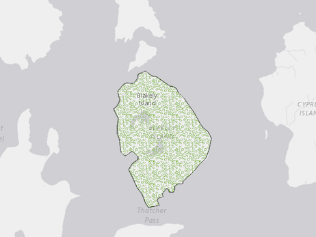
The image below depicts a Graphic that is styled with a PictureFillSymbol.
var symbol = new PictureFillSymbol({
  url: "https://webapps-cdn.esri.com/Apps/MegaMenu/img/logo.jpg",
  outline: {
    style: "none"
  },
  width: "15px",
  height: "15px"
});
Constructors
new PictureFillSymbol(properties)
properties Object See the properties for a list of all the properties that may be passed into the constructor. |
Property Overview
| Name | Type | Summary | |
|---|---|---|---|
| String | The name of the class. more details | more details | |
| Number | The height of the image in points. more details | more details | |
| SimpleLineSymbol | The outline of the polygon. more details | more details | |
| String | For PictureFillSymbol the type is always | more details | |
| String | The URL to the image. more details | more details | |
| Number | The width of the image in points. more details | more details | |
| Number | The offset on the x-axis in points. more details | more details | |
| Number | The scale factor on the x axis of the symbol. more details | more details | |
| Number | The offset on the y-axis in pixels or points. more details | more details | |
| Number | The scale factor on the y axis of the symbol. more details | more details | |
Property Details
declaredClassStringreadonly
The name of the class. The declared class name is formatted as
esri.folder.className.The height of the image in points. This value may be autocast with a string expressing size in points or pixels (e.g.
12px).Default Value: 12Examples:// height in points symbol.height = 16;// height in pixels symbol.height = "12px";// height in points symbol.height = "16pt";outlineSimpleLineSymbol autocast
The outline of the polygon.
Example:var sym = SimpleFillSymbol({ color: "red", outline: { color: [128, 128, 128, 0.5], width: "0.5px" } });typeStringreadonly
For PictureFillSymbol the type is always
picture-fill-symbol.urlString
The URL to the image.
The width of the image in points. This value may be autocast with a string expressing size in points or pixels (e.g.
12px).Default Value: 12Examples:// width in points symbol.width = 16;// width in pixels symbol.width = "12px";// width in points symbol.width = "16pt";The offset on the x-axis in points. This value may be autocast with a string expressing size in points or pixels (e.g.
12px).Default Value: 0Examples:// xoffset in points symbol.xoffset = 6;// xoffset in pixels symbol.xoffset = "8px";// xoffset in points symbol.xoffset = "6pt";xscaleNumber
The scale factor on the x axis of the symbol.
Default Value: 1The offset on the y-axis in pixels or points. This value may be autocast with a string expressing size in points or pixels (e.g.
12px).Default Value: 0Examples:// yoffset in points symbol.yoffset = 6;// yoffset in pixels symbol.yoffset = "8px";// yoffset in points symbol.yoffset = "6pt";yscaleNumber
The scale factor on the y axis of the symbol.
Default Value: 1
Method Overview
| Name | Return Type | Summary | |
|---|---|---|---|
| PictureFillSymbol | Creates a deep clone of the symbol. more details | more details | |
| * | Creates a new instance of this class and initializes it with values from a JSON object generated from a product in the ArcGIS platform. more details | more details | |
| Object | Converts an instance of this class to its ArcGIS Portal JSON representation. more details | more details | |
Method Details
clone(){PictureFillSymbol}
Creates a deep clone of the symbol.
Returns:Type Description PictureFillSymbol A deep clone of the object that invoked this method. Example:// Creates a deep clone of the graphic's symbol var sym = graphic.symbol.clone();fromJSON(json){*}static
Creates a new instance of this class and initializes it with values from a JSON object generated from a product in the ArcGIS platform. The object passed into the input
jsonparameter often comes from a response to a query operation in the REST API or a toJSON() method from another ArcGIS product. See the Using fromJSON() topic in the Guide for details and examples of when and how to use this function.Parameter:json ObjectA JSON representation of the instance in the ArcGIS format. See the ArcGIS REST API documentation for examples of the structure of various input JSON objects.
Returns:Type Description * Returns a new instance of this class. Converts an instance of this class to its ArcGIS Portal JSON representation. See the Using fromJSON() topic in the Guide for more information.
Returns:Type Description Object The ArcGIS Portal JSON representation of an instance of this class.